WHO WE ARE
Our missions
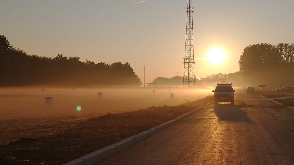
The SIRTA Atmospheric Research Observatory is one of few sites in Europe offering the instrumentation and the facilities to study atmospheric physico-chemical processes from the surface to the upper troposphere through the boundary layer. At SIRTA, we study climate variability at regional and decadal scales and evaluate the performance of atmospheric models (climate projection, weather forecast, chemistry-transport, etc.).

SIRTA addresses the needs of four missions that span on multi-decadal time scales:
- Atmospheric Monitoring: SIRTA carries out and provides access to long time series of atmospheric observations necessary to improve our knowledge of atmospheric physico-chemical processes (gases, aerosols, clouds, precipitation, thermodynamics, dynamics, radiation), to study climate variability on decadal and regional scales, and to evaluate atmospheric models.
- Atmospheric Exploration: SIRTA hosts experimental measurement campaigns in a rich observational environment, equipped with efficient logistics. It allows us to explore complex atmospheric processes, to develop methods exploiting instrumental synergies (tracers, in-situ series and remote sensing), to prepare future satellite observations and validate on-going ones, to develop new parameterizations for models, to test and qualify new instruments.
- Experimental teaching: SIRTA allows the realization of experimental work and teaching projects that take place as part of atmospheric science courses (hosting of students at Bachelor, Master and Doctorate levels) (internal link to the page).
- Metrological and radiative expertise: SIRTA hosts two expertise centers of the ACTRIS European Research Infrastructure (internal link to the page) which aim at improving the quality of measurements, methods and data of networks of observations of physical properties of clouds (CCRES) (internal link to the page) and the physico-chemical properties of aerosols (ACMCC).(internal link to the page). SIRTA also hosts and maintains a surface radiation budget station that contribute to the Baseline Surface Radiation Network (BSRN).
The scientific perimeter of activities carried out at SIRTA includes reactive and greenhouse gases, aerosols, clouds, and precipitation, radiative exchanges, heat fluxes, atmospheric dynamics and thermodynamics. The scientific applications also concern the use of these fields of expertise to study their impact on human activities such as health, transport and energy (with a particular focus on solar and wind renewable energies).
Our motivations
The Institut Pierre Simon Laplace (IPSL) developed since 1999, with its partners, an atmospheric research observatory, the SIRTA, to gather its atmospheric observation means, to implement reference observation procedures, to develop multi-decadal data sets for the research needs of the national and international scientific community and for teaching purposes in the Paris region.
Our motivations are historically to serve the scientific needs and to enhance the scientific community mobilisation.
Serving the scientific needs
The parameters with a predominant role in the radiative feedbacks of the climate system are atmospheric humidity, adiabatic thermal gradients, clouds and surface albedo (Dufresne and Bony, 2008). Among these parameters, clouds are the dominant contributors to the uncertainties in climate simulations responding to various scenarios of CO2 emission scenarios. Multiple interactions between aerosols, humidity, clouds and radiation, in a dynamic environment greatly complicate climate predictions. The climate research community recognizing the link between climate uncertainties and the complexity of atmospheric processes (DOECESD, 2013), has demonstrated over the last twenty years the need to make co-located observations of thermodynamic parameters (temperature, humidity, wind), atmospheric components (reactive gases, aerosols, clouds) distributed over the entire atmospheric column from the surface to the stratosphere, and associated radiative components.
To simultaneously observe this set of essential climate variables it is necessary to gather sensors capable of observing a wide range of gaseous species and concentrations of solid and liquid particles, but also sensors that are sensitive to the dynamic movements of the atmosphere on highly variable scales. It is necessary to be able to quantify the concentrations of water vapor molecules, to distinguish between water and ice particles constituting clouds, as well as aerosols, whose sizes can vary by a factor of 100, and to identify the large droplets. Similarly, it is necessary to quantify the turbulence within the flows which plays a central role in the mix and entrainment in the surface layer but also in the upper Troposphere.
Moreover, the definition of public policies aiming at reducing the health and environmental impacts of air pollutants is closely linked to our knowledge of pollution sources, their contribution to secondary pollution, and their evolution over the long term. The Paris region is a particularly complex case study given the multitude of emission sources and the influence of atmospheric dynamics in the Paris basin. The measurement of reactive gases and physico-chemical properties of particles in real time and in the long term becomes essential, and proves to be a real asset in our understanding of the sources and of the pollution formation processes.
Enhancing the scientific community mobilisation
The observation strategy adopted at the international level (e.g. Haeffelin et al., 2016) to improve the understanding of atmospheric processes requires the gathering of diverse observational resources at observatories, including some complex instruments such as Lidars and Radars. Thus the program “Atmospheric Radiation Measurement (ARM2), launched by the American Department of Energy in the mid-1990s, and the European research programs (CloudNet, Earlinet, EUSAAR – Cite reference) launched in the early 2000s, then grouped within the ACTRIS program (internal link to the page) since the 2010s (FP7, then H2020), have set up Atmospheric observatories in several parts of the world, particularly in the USA and Europe combining in-situ sensors and remote sensing means to probe and monitor these processes.
At the global level, the Global Climate Observing System (GCOS) program, noting that the quality of certain observations is still insufficient to provide reliable answers to climate questions, is setting up an international network of reference observatories to build a new reference dataset. At the national level, observation services have been set up for the past 20 years with the aim of providing long-term quality observations of several key climate parameters over several geographical regions (Europe, Africa, Southern Territories). More recently (>2007), the national community also recognized the importance of supporting the development of Instrumented Sites, in a limited number of locations, with increased observation and experimentation capacity, gathering means from several observation services (labelled and others).


